

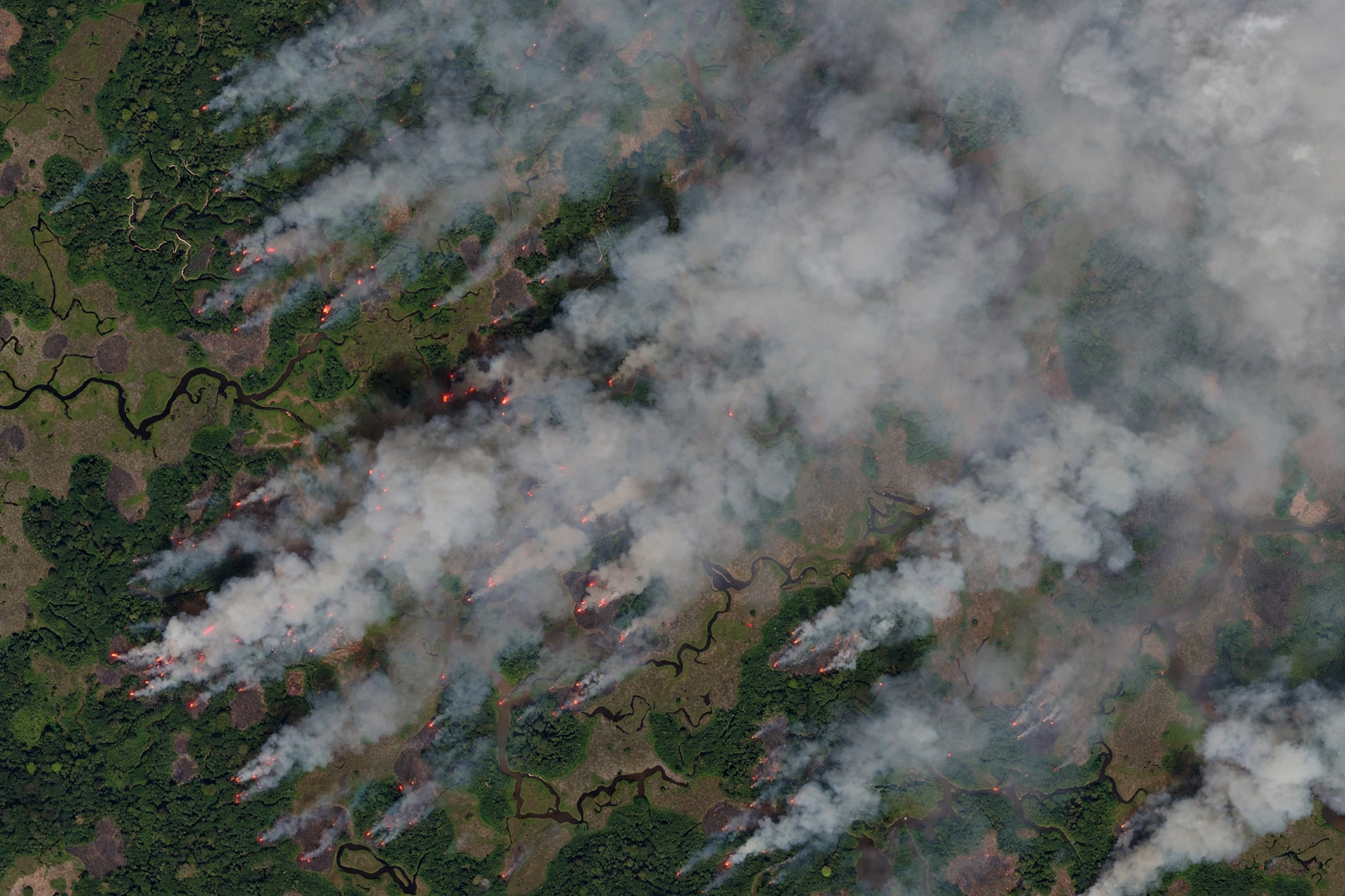
Satellites are helping to track Indonesian peat fires that continue to burn into the final weeks of October, as thick smoke drifts across Southeast Asia. Fire teams on the ground are still battling blazes that refuse to go out, even where the surface flames have been put down.
New Earth observation data published by NASA’s Earth Science Data and Information System shows the cross-border footprint of the disaster. Imagery from the Visible Infrared Imaging Radiometer Suite, known as VIIRS, aboard the joint NASA and NOAA-21 satellite recorded dense clusters of red thermal anomalies over Kalimantan, pointing to active fires and smouldering landscapes underground.
The satellite picture is backed up by sensors on the ground. Stations in the Aerosol Robotic Network at Pontianak, Jambi and Singapore have logged high aerosol optical depth values, which signal particle densities high enough to severely obscure sunlight and reduce visibility.
The smoke is not staying inside Indonesia. Spectral analysis of the 380-nanometre ultraviolet aerosol index layer shows the deepest red colours directly over burning peatlands in Kalimantan, with broader orange and yellow plumes marking particle-laden air drifting across the Malacca Strait toward Malaysia and Singapore.
Fires that burn underground
The challenge lies in the nature of tropical peat. Drained by canals for farming and plantations, deep peat layers can burn metres underground without open flames. These low-temperature, smouldering blazes evade aerial water bombing and release heavy volumes of carbon monoxide, methane and fine particulate matter known as PM2.5.
Indonesia’s Meteorology, Climatology, and Geophysical Agency, known as BMKG, has recorded PM2.5 concentrations above the hazardous benchmark of 250.4 micrograms per cubic metre in several districts. That is air that is dangerous to breathe, especially for children, older people and anyone with a lung condition.
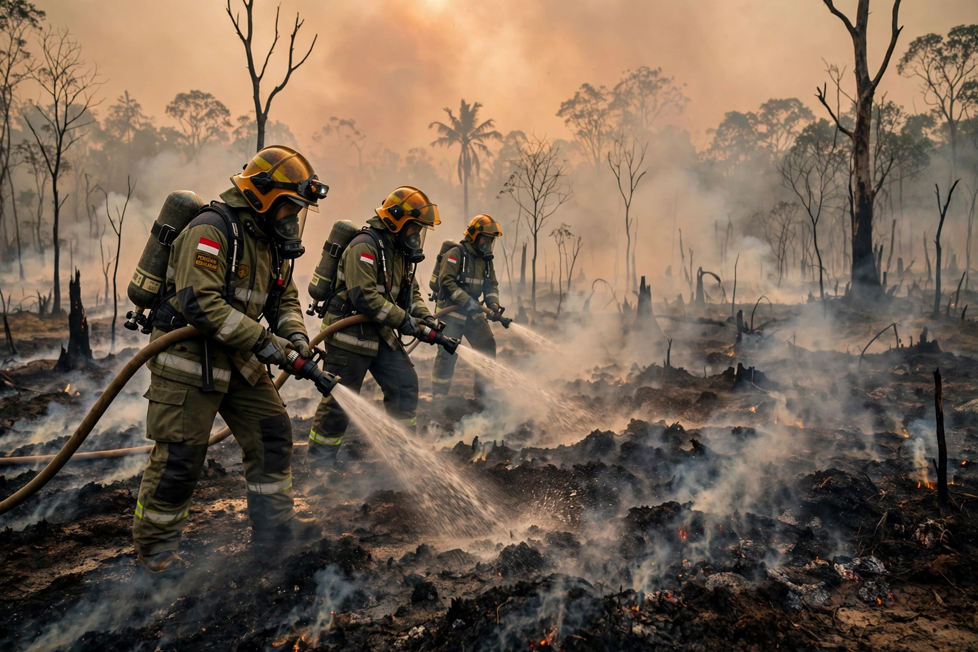
Emergency crews have subdued the main surface fronts across parts of South Sumatra, West Kalimantan and Riau. Even so, hundreds of hectares remain actively burning or smouldering in Central Kalimantan and Jambi, according to emergency personnel.
NASA’s MODIS instrument aboard the Aqua satellite captured a true-colour image of fires and air pollution over Indonesia and Papua New Guinea on 9 October. It showed severe and widespread peatland wildfires filling the skies with smoke. Indonesia holds about 36 percent of the world’s tropical peatlands.
Drier than usual conditions, drought and delayed rainfall linked to El Nino have made the fires worse. With the monsoon rains late, drained peatlands were left acutely vulnerable, and fire activity roughly doubled in a single month.
A huge carbon cost
Independent satellite tracking from environmental monitor Nusantara Atlas shows that the cumulative burned area in Indonesia passed 1.9 million hectares through September. That figure is backed by separate reporting, which put the area at 1.92 million hectares by the end of September, double the area burned a month earlier.
The climate cost is enormous. Early figures from the Global Fire Emissions Database indicate that the fires generated at least 76 million tons of carbon, equal to about 278 million tons of carbon dioxide, before entering the peak burn weeks of late September and October.
With active smouldering still going on, seasonal emissions are projected to reach between 400 and 500 million tons of carbon dioxide equivalent. That would approach the levels seen during the severe fire crisis of 2019.
That volume matters far beyond Indonesia. The United Nations Environment Programme’s latest Emissions Gap Report documented an overall 2.3 percent surge in global greenhouse gas emissions, an annual net increase of about 1.3 gigatons of carbon dioxide equivalent.
The Indonesian peat fire season alone represents roughly a quarter to more than a third of that entire global net increase. In effect, smouldering peat in one archipelago threatens to offset the emissions avoided through years of investment in solar, wind and transport electrification across Southeast Asia.
Smoke crosses borders
The drift has also triggered legal friction across borders. Singapore has invoked its Transboundary Haze Pollution Act, serving formal notices to several plantation operators holding concession lands connected to active fire signatures.
The haze has sent air pollution levels surging to dangerous levels not only in Indonesia, but also in Malaysia, Singapore and East Timor, prompting the ASEAN regional bloc to call a meeting over the crisis. Singapore has promised legal action against companies responsible for the fires.
BMKG forecasts project gradual monsoon rains developing across Sumatra and Kalimantan through late October and November. Monitoring networks warn, however, that until consistent rainfall saturates the water table and re-floods canal networks, smouldering peat beds will keep venting greenhouse gases and particulate haze across regional airspace.
Satellites cannot put the fires out. What they can do is show exactly where the fires are, how far the smoke reaches, and how much carbon is going into the air. For fire crews, for health officials, and for the governments now arguing over the haze, that picture from space has become the clearest record of a disaster that is still burning.